
www.maps.google.com
Google, the most innovative company on the planet, recently came up with an additional feature for Google Maps, that will be useful to Adventurers. Now, not only can someone use Google Maps for planning driving directions, they can also look at the Google Terrain view tab, which will allow them to check out the topography of a place they may want to hike. This feature will be great to plan hiking routes, or just to get a better lay of the land before setting off on an adventure. Of course you need to know how to read a topographic map, but any Adventurer worth their gorp already knows how to do that. I reccomend for everyone to take a look at this feature before your next wilderness forray.
Below are Google Maps screenshots of Camelback Mountain in Arizona, and the North Rim of the Grand Canyon. 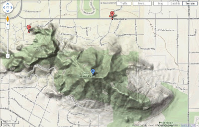
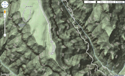
Above: Camelback Below: Grand Canyon
Also reccomended: look at Mount Everest